Thursday 31 December 2009

Cheese Bread Bake


Material:
- 12 slices white bread, without skin
- 500 cc milk
- 1 / 2 tsp pepper finely
- 75 g onion, chopped
- 150 gr bacon, chopped
- 50 grams grated cheese, for topping
- Salt if necessary
How to Make:
* Arrange bread on a hot plate that was resistant butter / margarine. Stir all ingredients until smooth. Pour over bread, sprinkle with remaining grated cheese. Bake until cooked through and browned. Serve hot.

Concrete Tidal Wall

PEMBAHASAN
Tembok laut beton adalah struktur bangunan yang keras dan kuat yang dibangun di bagian dalam pantai untuk mengurangi kekuatan gelombang (wikipedia).


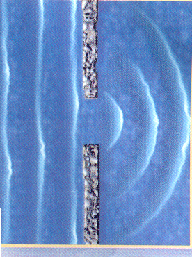
Gambar 1. Tampang melintang concrete tidal wall

Tembok laut beton pada umumnya berukuran standar, hanya tinggi puncak saja yang dihitung berdasarkan kondisi hidrolis setempat.

Dalam penentuan desain awal sebuah tembok laut beton harus sudah ditentukan mengenai fungsi dan strukturnya. Dengan tujuan utama sebagai pengurang atau penghambat air laut masuk ke wilayah daratan, maka sebaiknya bangunan ini ditempatkan di daerah agak jauh dari pantai dan disarankan untuk membuatnya di daerah perumahan penduduk. Jika ombak atau gelombang yang terjadi masih sangat besar, maka diperlukan juga beberapa bangunan pelindung pantai lainnya di depan tembok laut ini. Pondasi tiang (sheet pile) juga menjadi parameter yang harus di perhatikan. Pondasi ini sangat bergantung kepada parameter tanah seperti tegangan geser (shear capacity) dan daya dukung tanah (bearing capacity), tetapi pada kesempatan ini saya hanya akan membahasa mengenai bangunan tembok laut tanpa menggunakan pondasi tiang.

Pembuatan tembok laut beton ini didasarkan pada besarnya serangan gelombang. Di sini ada dua jenis beton penahan yang akan dibahas, yakni :

- Tembok laut tanpa pelindung (tidak memperhitungkan gelombang yang terjadi).
- Tembok laut dengan lapisan pelindung tumpukan batu (memperhitungkan serangan gelombang).

berikut adalah hal-hal yang pelu diperhatikan dalam penyusunan desain utama tembok laut :
1. Tinggi puncak, meliputi desain permukaan air dan tinggi jagaan (kalkulasi tinggi puncak).
Untuk menentukan tinggi puncak gelombang pada bangunan beton, digunakan perumusan :

h = HAT + SLR + LS
dengan ; h : Desain permukaan air, sesuai MSL (m).
HAT : High Astronomical Tide, mengacu terhadap MSL (m).
SLR : Estimasi kenaikan permukaan air laut untuk 25 tahun (m).
LS : Estimasi penurunan muka tanah untuk 25 tahun (m).

Catatan : untuk perhitungan serangan gelombang selalu diperhitungkan terbatas dan relatif karena penempatan tembok laut beton ini berada di wilayah pemukiman. Pembuatan pelindung dasar rubble mound hanya untuk mengurangi gerusan yang berada di depan bangunan. Hempasan dan runup gelombang tidak diperhitungkan dalam skala signifikan. Dan tinggi jagaan Rc, nilai minimal yang dipakai adalah 0,5 m.


2. Tanggul tanah, meliputi keseimbangan vertikal dan panjang piping.
Tujuan dari pembuatan tanggul tanah ini adalah untuk membuat tembok laut beton ini menjadi kedap air. Untuk ukurannya ditentukan oleh kriteria sebagai berikut :
- Tekanan air tanah (uplifting).
Tekanan air tanah yang berada di belakang bangunan tembok laut harus memiliki tinggi minimal untuk mencegah terjadinya timbulan (heave). Timbulan adalah suatu proses dimana air yang berada di bawah tanggul tanah timbul ke atas permukaan. Tekanan bawah yang didesak oleh berat tanah harus lebih besar dari tekanan atas yang disebabkan oleh permukaan air melewati bangunan.


- Piping.
Panjang timbunan yang berada di belakang bangunan tembok laut ditentukan oleh kebutuhan piping. Panjang pola aliran di bawah bangunan harus cukup besar untuk mencegah terbentuknya saluran-saluran kecil karena aliran air ini dapat merusak bangunan. Akan tetapi, jika panjang timbunan terlalu pendek maka air akan merembes dan mengakibatkan banjir di daratan. Berikut adalah parameter piping untuk material tanah yang berbeda.

3. Stabilitas geoteknikal, meliputi prosedur dan kesalahan mekanisme (kontruksi cutoff-wall).
Stabilitas geoteknikal ditentukan oleh gaya horizontal dan vertikal dari tanah dan air. Perhitungan tentang masalah ini dilakukan oleh ahli geoteknik.


Dengan adanya perhitungan mekanika tanah maka kita bisa mengetahui apakah suatu bangunan sesuai dengan stablitas yang kita inginkan. Hal ini ditentukan oleh ketahanan struktur tembok beton terhadap kesalahan mekanisme sebagai berikut :

- Terangkat (uplifting)
Tekanan air di bawah bangunan menginduksi tekanan di atasnya. Tekanan di atas adalah gaya gerak untuk mengankat bangunan ke atas. Jika tanpa pondasi tiang, maka gaya tekan hanya terdiri dari berat bangunan saja.

- Bergeser (sliding)

- Tidak stabil (overtuning)
Tekanan pada setiap sisi menyebabkan bangunan cenderung berotasi pada bangunan kaki. Perubahan momen gerak disebabkan oleh tekanan tanah pada satu sisi, sementara tekanan vertikal pada bangunan dan tekanan yanah pada sisi lain menginduksi momen.

- Terbalik (ecccentricity)
Tanah yang berada di bawah bangunan dapat turun karena ketidakstabilan gaya residual, seperti kapasitas tanah yang terjadi lebih rendah dari nol pada kaki.

Sunday 27 December 2009

Raja Ampat (kekayaan alam Indonesia)

Kabupaten Raja Ampat adalah salah satu kabupaten di provinsi Papua Barat, Indonesia. Ibukota kabupaten ini terletak di Waisai. Kabupaten ini memiliki 610 pulau. Empat di antaranya, yakni Pulau Misool, Salawati, Batanta, dan Waigeo, merupakan pulau-pulau besar. Dari seluruh pulau, hanya 35 pulau yang berpenghuni. Pulau lainnya tidak berpenghuni dan sebagian besar belum memiliki nama. Sebagai daerah kepulauan, satu-satunya transportasi antar pulau dan penunjang kegiatan masyarakat Raja Ampat adalah angkutan laut. Demikian juga untuk menjangkau Waisai, ibu kota kabupaten. Bila menggunakan pesawat udara, lebih dulu menuju Kota Sorong. Setelah itu, dari Sorong perjalanan ke Waisai dilanjutkan dengan transportasi laut. Sarana yang tersedia adalah kapal cepat berkapasitas 10, 15, atau 30 orang. Dengan biaya sekitar Rp. 2 juta, Waisai dapat dijangkau dalam waktu 1,5 hingga dua jam.

Pada tahun 2002, The Nature Conservancy (TNC) dan para mitra lainnya mengadakan suatu penelitian ilmiah untuk memperoleh data dan informasi tentang ekosistem laut, daerah bakau dan hutan Kepulauan Raja Ampat. Survei ini menunjukkan bahwa terdapat sejumlah 537 jenis karang, yang sungguh menakjubkan karena mewakili sekitar 75% jenis karang yang ada di dunia. Ditemukan pula 828 jenis ikan dan diperkirakan jumlah keseluruhan jenis ikan di daerah ini 1.074. Di darat, penelitian ini menemukan berbagai tumbuhan hutan, tumbuhan endemik dan jarang, tumbuhan di batuan kapur serta pantai peneluran ribuan penyu.

Kegiatan manusia di kepulauan ini belum memperlihatkan dampak negatif yang berarti dibandingkan dengan kawasan terumbu karang di tempat lainnya di Indonesia, namun ancaman-ancaman karena praktek-praktek yang tidak ramah lingkungan seperti penggunaan bom, racun (sianida), pengambilan telur penyu dan penebangan hutan yang tidak memperhatikan aspek-aspek kelestarian diperkirakan akan mengganggu keutuhan ekosistem yang ada. Pemerintah Indonesia baru saja menetapkan kawasan Raja Ampat sebagai kabupaten baru yang mandiri, yang merupakan kesempatan besar bagi masyarakat setempat untuk mengelola sumberdaya alam Raja Ampat untuk masa depan kehidupan mereka. Pemerintahan baru ini juga menawarkan peluang untuk turut mempertimbangkan aspek pelestarian alam dalam perencanaan tata ruang kabupaten baru.

Menanggapi tawaran dan sekaligus untuk membantu pemerintah daerah, maka TNC meluncurkan suatu program kerja yang bertujuan untuk melindungi Kepulauan Raja Ampat yang dilakukan bersama pemerintah dan masyarakat Raja Ampat. Program ini bertujuan: 1) menyumbangkan suatu rencana kegiatan konservasi menyeluruh untuk melindungi terumbu karang dan hutan Kepulauan Raja Ampat; 2)membantu menyelaraskan pengelolaan kawasan perlindungan laut ke dalam perencanaan dan kebijakan pembangunan jangka panjang; serta, 3) mengembangkan suatu jaringan kawasan perlindungan.

Tujuan akhir kehadiran TNC di Raja Ampat adalah melindungi kekayaan terumbu karang Kepulauan Raja Ampat yang sekaligus diharapkan akan menjamin kehidupan masyarakat lokal.
Raja Ampat tersusun atas empat pulau besar, yaitu Waigeo, Batanta, Salawati dan Misool serta ratusan pulau kecil. Kepulauan ini merupakan bagian dari bentangan laut daerah Kepala Burung yang termasuk pula kawasan Teluk Cenderawasih, yaitu taman nasional laut terbesar di Indonesia.


Bangga Indonesiaku


Indonesia adalah negara kepaulaun yang satu wilayah dengan wilayah yang lainnya terpisah oleh adanya lautan yang membelahnya. Setiap kepulauan besar memiliki ratusan hingga ribuan gugusan pulau kecil yang dihuni oleh beratus-ratus suku dengan adat-istiadat yang berbeda. Dan dari adat-istiadat ini melahirkan beribu-ribu kebiasaan serta watak yang berbeda-beda dan unik.

Beragam sumber watak dan perangai manusia yang begitu kompleks dan berlawanan memang menjadi suatu nilai tarik sendiri. Maka tidaklah heran jika semboyan negara kita adalah “Bhineka Tunggal Ika” yang berarti walau berbeda-beda namun tetap satu kebangsaan yakni Indonesia tercinta. Hal inilah yang mendasari terciptanya suasana toleransi antar suku yang harmonis, tidak ada persaingan untuk meninggikan kebudayaan masing-masing suku karena kebudayaan daerah adalah kebudayaan Indonesia yang menjadi kewajiban setiap warga negara untuk menjaga dan melestarikannya.

Suasana yang ramah dan bersahabat adalah salah satu daya tarik lain dari kondisi dan kultur masyarakat Indonesia. Amat sangat jarang sekali kita temui orang Indonesia yang bertemu tanpa bertutur sapa terlebih dahulu, setidaknya untuk kalangan Islam misalnya maka satu diantara yang lainnya saling mengucapkan salam dan membalas salam tersebut. Ini adalah tradisi yang tak boleh hilang dan harus tetap ada untuk setiap jiwa masyarakat Indonesia. Karena dengan perasaan saling mengerti dan perhatian antara kondisi satu dengan yang lainnya inilah yang akan membuat kerukunan semakin tercipta sehingga tidak akan terjadi peristiwa-peristiwa yang tidak kita inginkan bersama.

Terima ksih Ya Allah swt, karena engkau telah melahirkan hamba di bumi yang penuh kesuburan ini. Jayakan negeri ini dan jadikan negeri ini sebagai baldatun thoyyibah, yang penuh kemakmuran , kebenaran, dan kebaikan. Indonesiaku, aku bangga padamu.

Groin


Groin is one type of security structure which is designed to shore along the coast to build a stable beach. Usually groin constructed with natural stone materials, tribar, dolos and so on. Groin operationally defined by several conditions (CERC, SPM Vol 1, 1984), namely: Groin only be used to transport longshore conditions. Adjustment groin circumstances surrounding beaches will depend on the distance and direction of longshore transport. The results accumulated by longshore transport of beach groin will change the profile of the beach. Waves that forged groin will sometimes be reflected into the offshore along the groin. The percentage of longshore transport through the groin will depend on the dimensions groin, groin filler materials, water level and wave climate.

The advantage of using the groin:
a) Groin effectively restrain the transport of sediment parallel to shore
b) The data indicates the efficiency of the groin in the physical environment
c) Groin can be built by the placement of equipment on the ground
d) does not change Groin surf zone. High waves along the coast after groin construction does not change, so as not to interfere with surfing and swimming at the beach
e) Groin can be planned using a variety of materials, such as rubble-mound, steel sheet pile, concrete and wood
f) The set of dimensions and permeabilitasnya, can be designed to resist groin parallel transport or allow the release of beach sand into the sea (sand by passing)

Weaknesses in the groin are:
a) Not effective in preventing the transport of sediment out to sea (offshore transport)
b) Groin may cause gusuran beach dihilirnya (down drift)
c) Lack of effective use in the muddy shore

Detached Breakwater


Is the type of breakwater is placed separately at a certain distance from the beach with a position parallel to the beach that serves to protect the coast from the blow waves coming from offshore. Besides the breakwater is useful to resist tidal sediment transport.

There are two types of Breakwater is a common type of construction (CERC, SPM, vol 1, 1984), the Shore-connected Breakwater Breakwater and offshore. Shore-connected Breakwater characterized that this structure directly related to the mainland.
Breakwater offshore whereas the opposite is not physically connected to the mainland, they almost certainly have similarities in their role.

The advantage of using detached Breakwater (DB) is:
a) Self-effective to restrain the transport of sediment off the coast (on-offshore transport).
a) The ability in stabilizing the beach has been proven.
b) Can be designed to maintain the aesthetics of the beach because the construction can be designed with a threshold of drowning (Submerged Breakwater).
c) construction is designed not difficult to use local materials, such as rubble-mound construction (rock pile).
d) The design allows overtopping, then behind the water quality can be improved detached Breakwater.
e) Placement detached Breakwater near the coast can work to reduce the wave height along the coast.

The weakness of the use of detached Breakwater (DB) is:
a) Detached Breakwater built rather difficult because apart from the beach and need temporary building or building a floating untu8k support construction equipment required.
b) Detached Breakwater surfzone can change characters and can limit specific activities on the beach, like windsurfing, diving, bathing the surrounding buildings
c) Dangerous for swimmers.
d) a poor design will cause water quality problems due to poor circulation in the back.
e) Detached Breakwater can form TOMBOLO. This raises the parallel transport barrier beaches and cause serious problems downdrift miscarriages

Tidal Analysis


Is the tidal sea level fluctuations as a function of time because of the gravity objects in the sky, especially the sun and moon on the water mass on earth. Although the month of mass much closer, then the influence of gravity to the earth the moon is bigger than the influence of gravity of the sun.

Knowledge is very important tide in the harbor planning. Elevation of the highest water level (tide) and lowest (low tide) is very important to plan for the port buildings. For example, the peak elevation of the building the breakwater, dock, etc.. Front elevation is determined by the tide, while the depth of the cruise line / port specified by the face I \ waters recede. High tide is the vertical distance between high water (tide peak) and water lowest (valley low tide) is a sequence. Tidal period is the time required from the position of water level on the average water level to the same position the next. Tidal period could 12 hours 25 minutes or 24 hours 50 minutes, depending on the type of ups and downs. Period of rising water on the face called pairs, was at the time called the ebb down sir. Variations of a current water level is called the tidal currents, water mass carrying very large amounts. High tide occurs at the time period and flow ebb tide occurred at low tide period. The turning point (slack) is where the flow turns the tide ebb and flow. These turning points can occur at the highest water level and the lowest water level. At the current velocity is zero.

Tide forms in various regions are not the same. In an area in one day could happen once the tide. In general tide in various regions can be distinguished four types, namely single daily tidal (diurnal tide), the daily double (semidiurnal tide) and two kinds of mixtures.

1. Single daily tides (diurnal tide)
In one day happen once the tide and one low tide with tidal period is 24 hours 50 minutes. This type of tide occurred in the waters of the strait Karimata.

2. Double the daily tides (semi-diurnal tide)
In one day happens twice tide and low tide twice with similar ringgi and tides occur on a regular basis, respectively. Type tidal average is 12 hours 24 minutes. This type of tide is in the Malacca Strait to the Andaman Sea.

3. Mixture tidal inclined to double daily (mixed semidiurnal tide tide prevelailing)
Happen in one day the tide twice and both times the water receded, but the high and the period is different. This kind of tidal many diperairan Eastern Indonesia.

4. Mixed tidal biased toward a single daily (mixed diurnal tide tide prevelailing)

Wave Refraction


The speed of propagation of waves depends on the depth of water where the wave propagates. If the rapid propagation of the wave decreases with depth, the wavelength also decreases linearly. Rapid variations occur in the propagation of waves along the wave crests move by forming an angle to the line depths of the sea, as part of a wave at sea in moving faster than the parts in a more shallow sea. These variations cause wave crests and tried to turn parallel to the seabed contour lines.

Wave refraction and shallow (shoaling wave) will be able to determine the wave height in a place based on the characteristics of the wave coming. Refraction has a significant influence on wave height and direction and wave energy distribution along the coast.

Changes in wave direction due to refraction produces convergence (reduction) or divergence (spreading) wave energy and wave energy that affects occur somewhere in the coastal region.
Assumptions used in the study of refraction are as follows.

a) The energy between the two orthogonal wave is constant.
b) wave spreading direction perpendicular to the top of the wave, ie in the direction orthogonal to the wave.
c) Rapid propagation of waves that have a certain period in a place only depends on the depth at the venue.
d) basic topographical changes are gradual.
e) A wave has a long peak, the period of constant, small amplitude and monokhromatik.
f) The influence of currents, winds and reflection from the beach and seabed topography changes are ignored.
Traveling wave with a wavelength in the sea in Lo, near the beach with a peak orientation at sea in parallel with the shoreline location average.

Wave Diffraction


When the waves came hindered by obstacles such as a breakwater or island, the waves will be turned on around the end of the barrier and entered the protected area behind it. Diffraction occurs when there are differences in the sharp wave energy along wave crests. At first the conditions in the protected area barrier quiet enough (there are no waves), as a wave across the barrier. Waters far from the barrier will have more energy (initial wave energy) than the waters behind the barrier which had been quiet (no energy because there are no waves), the energy transfer process occurs at the crest length to the area of protected coastal buildings.
Transfer energy to the establishment of protected areas causing waves in the area, though not as big waves outside the protected areas. Crest lines in the back and have turned obstacles arc shape with its center at the end of the obstacle. Considered that the water depth is constant. If not, then it also occurs in addition to the diffraction wave refraction. Usually reduced wave height along the crest toward the protected area.

When the wave went through a structure there will be a transfer of wave energy in line with the peak of the wave inside the structure. Concentration of energy density will lead to periods of higher waves of the spectrum. With KD to determine the distance from the wave period and direction, one can evaluate the characteristics of the wave spectrum at a point in
areas protected by coastal structures in order to plan the wave damping structure.

Wave Breaking


Wave breaking can be categorized into the following three types.

1. Spilling
Spilling waves usually occur when a small slope towards the flat beach (small slope). Waves breaking at a considerable distance from the beach and the outbreak occurred gradually. Foam occurs at the peak of the wave during broken and left a thin layer of foam on a long distance.

2. Plunging
If the slope of the wave and the base increases, the wave will break and the peak wave will play with the mass of water at the peak of the wave will jump to the front. Broken wave energy was destroyed in the turbulence, a small portion is reflected to the sea coast, and not much new wave occurred in the more shallow water.

3. Surging
Surging occurs on the beach with a very large slope, as happened in the rocky shore. Region is very narrow wave broke, and most of the energy reflected back into the deep ocean. Surging type breaking wave is similar to the plunging, but before the top falls, the basic wave has broken.

Beach Behavior

Coast is a dynamic interaction between water, wind and soil materials. Water and wind move from one place to another, eroding the soil and then deposited so that the shoreline changes. The process of coastal change is a dynamic process, and if this continues it will interfere with the activities around the coast, because it will happen or erosion and accretion in the coastal area. According to Kakisina (2004) beach behavior can generally be categorized into 3 types, namely:

1. The beach is eroded (erossion coast).
Coastal erosion of the shoreline setback to the ground, which can damage residential areas and urban infrastructure. Beach erosion can occur naturally due to wave attack or because of human activities in the form of mangrove deforestation, taking coral beach, port development, reclamation and others.

2. The beach is stable (stable coast).
The beach is basically the same stable with the eroded coast beaches where stable behavior is constant. This means that although the volume profile fluctuates, but overall volume is not changed with time.

3. Beach accretion (acresting coast).
Beach accretion mechanism is also similar to coastal erosion and a stable, only shoreline moves toward the sea. This means that fluctuations in the volume of the profile increases with time.

Artificial Causes of Coastal Erosion


Artificial causes of coastal erosion include:

a. Soil degradation
Soil degradation can occur due to ground water taking uncontrolled, or due to oil and other mineral materials.

b. Quarrying sand
One reason for coastal erosion is the excavation of sand and other minerals from coastal areas and beaches. Excavation will reduce the reserves of sand in the area that can be eroded coastline.

c. Coast parallel transport interruptions
This can happen because it perpendicular to the beach building. Perpendicular to the building can withstand transport rate of sediment transport from upstream, so the lack of sediment downstream, the result will occur in the upstream place accretion and erosion downstream.

d. Reduction of sediment supply to the beach
Supply blood circumstances beach sediment can occur due to human activities on land, such as the construction of dams and river regulation. Because of reduced sediment supply there will be transport beach material.

e. The centrality of wave energy on the beach
Making a building can lead to coastal wave energy concentration in the area, it can cause erosion.

f. The destruction of natural protection
In general, the beach has such a natural protective vegetation and a sand dune reserve. Destroying or the protective nature can result in coastal areas exposed to waves, so that these protected areas have no protection against the onslaught of the waves.

Natural Causes of Coastal Erosion

Natural causes of coastal erosion include:

a. Rising sea
Rise in sea level in the long term common in many places in the world. Sea level rise due to the relative decline in the face of the land (Land subsidence) or because of sea level rise is absolute. As a result of rising sea level, the shoreline may be backed slowly toward the mainland

b. Changes in sediment supply
Supply of sediment to coastal areas can be derived from the mainland (blastic sediment) or from the sea (biogenic sediment). Change in the sediment source of bias caused by the natural process of rock weathering on land or due to reduced river flow carrying sediment. Reduced sediment supply from the sea can be caused by a damaged reef areas or coral growth inhibition.

c. Storm Waves
Storm surge could cause beach erosion, this is caused by the storm occurred during the current perpendicular to the beach big enough to carry beach material. Generally the process of erosion caused by storm waves iniberlangsung in a short time and are termporer, because the eroded material will be left in the surf zone and will return to shore on a wave saait calm (swell). However, if the monitor is steep bathymetry and have trenches beach sediment carried in the unbiased back to the beach.

d. Overwash (runoff)
Overwash occurs when a high tide accompanied by high waves hit the coast passing over the tongue of sand (dune). As a result of the tongue Overwash be eroded beach sand and deposited on the inside tongue of sand.

e. Transport parallel to the beach
Selection (sorting) beach material can be changed according to the gradation of grain and circumstances of this wave resulting from wave activity. These changes may result in changes to the shoreline or beach erosion and accretion.

f. Transport by wind
Coastal erosion can be caused by sediments by wind terangkutnya land. Wind berberan in distributing sand beach in the direction parallel to the beach, where sand supply is smaller than the transport capacity then the erosion of coastal winds can occur.

Drilling Mud


Fluid drilling mud is used, which is designed to assist the process of drilling. Composition and physical properties of the mud is very influential on a drilling operation because one of the factors that determine the success or failure in a drilling is dependent on the drilling mud. Drilling speed, efficiency, safety, and cost of drilling depends on the drilling mud used.

The main functions of drilling mud are:
1. Cutting lifted to the surface.
2. Control the formation pressure.
3. Cools and lubricates the chisel and drillstring.
4. Cleaning the drill hole bottom.
5. Helping formation stability.
6. Protect productive formations.
7. Assisting in formation evaluation.

Drilling mud functions mentioned above is determined by the chemical composition and physical properties of mud. Errors in controlling the physical properties of the mud will cause the failure of the function of mud which in turn can lead to resistance drilling and finally lead to large losses.
Drilling mud generally has four components or phases:

a. Liquid phase (liquid or oil).
b. Reactive solids, ie solids which react with water to form colloids (clay).
c. Inert solids (solids that do not react).
d. Phase chemistry.
While grouping based drilling mud fluid phases, namely:
1. Freshwater mud (Fresh Water Mud).
2. Mud, salt water (Salt Water Mud).
3. Oil in water emulsion mud.
4. Oil base and oil base mud emulsion.
5. Gaseous drilling fluids.

Drilling mud is made and used in accordance with its function and in accordance with the formation to be penetrated. During the drilling process progresses, the drilling mud is always controlled their properties, especially the physical properties and chemical properties.
Drilling mud has become one of the important considerations in optimizing drilling operations. Therefore, to maintain and control the physical properties of drilling mud to fit desired, it is necessary to know the basics of drilling operations, especially regarding drilling mud, which covers some practical event, namely:

1. Measurement of density, sand content, and measurement of oil content in drilling mud.
2. Measurement of viscosity and gel strength.
3. Measurement of thick mud cake and filtration.
4. Chemical analysis of drilling mud.
5. Drilling mud contamination.
6. Measurement prices MBT (methylene Blue Test).

Semi-submersible

Is a unit with a floating deck system supported by columns (vertical structural elements) and pontoons (horizontal structural elements) that allow more flexible response, and independent of wave motion characteristics of a good response.

With such a configuration structure, some important notes on performansinya include the following: (1) on the deck structure, pontoon, columns and elements of its branches (bracings) occurs across the force and torque, (2) equipment layout elements are integrated in - structural elements such as the deck box, the column and pontoon, (3) the details of local connections are vulnerable to high voltage and fatigue, (4) required a high strength steel (high tensile steel) to reduce the weight of the structure, (5) construction of the structure requires types of full penetrated weld welding and special welding procedures and (6) there is the air gap between surface water and the deck to allow the waves on the deck structure (slamming).
A floating object will move depending on the direction of the waves, winds and currents. So with this Floating Structure. To make this object relatively moving anywhere, it is necessary straps or known by the mooring line. Mooring was placed around the platform so that the floating structure for the condition without the influence of waves, winds and currents will be in a position of equilibrium for the vertical and horizontal directions. Mooring numbers ranged from 9 to 13, depending on the type of platform. Each mooring is tied at two locations. The first location was in itself a floating structure (attached mooring place is known by the name Fairlead) while the second location are embedded in the seabed. So that now the forces acting on the platform is no longer just the waves, winds and currents, but involves the force (top tension) of each mooring is attached around this platform.

To take the oil and gas on the seabed, it is necessary transport equipment known as the Riser. Riser There are many models, but there are widely recognized 2 types, namely SCR (Steel Catenary Riser) and TTR (Top Tension Riser). Like the mooring line, this line Riser length of the platform to the seabed. For this type of SCR, Riser curvature of the line is similar to the curvature of the Mooring line. While TTR is a vertical type Riser (perpendicular) from the platform to the seabed. The number of SCR and TTR depending on the wells located on the seabed. Meanwhile, drilled wells will depend on the amount of reserves and production of the desired daily basis. With additional resulted Riser style styles other than the above mentioned working on the platform.

Thus for the analysis of movement of the floating structure to see the force components acting on both the vertical platform (weight, buoyancy and the vertical tension of each of Mooring and Riser) or horizontal (waves, wind, currents, and the horizontal tension of each Mooring and Riser). To design, but must take into account the factors above, also must take into account the amount of oil and gas reserves will be taken (how many barrels per day), so this will affect the number and selection of Riser diameter to be used. Another factor to be reckoned with is the location where the offshore oil rigs will operate for Environment Condition will be different if we are designing for the Gulf of Mexico or to Makassar Strait. So that information about MetOcean be important for this initial process.
Viv can be formed around Riser for current flow or also around Spar because the flow of waves, winds and currents. To Riser (especially type TTR) is a challenge because of the amount of TTR is more than one and its position adjacent (Riser spacing generally ranges from 10 ft in length is more than 3000ft vertical direction) should be anticipated that each Riser did not collide. This paper will be more focused on issues surrounding Viv Spar (Spar, where the movement is also influenced by Viv caused by Riser).

Spar is a type banguan floating offshore shaped like a standing cylinder (see Figure 1). If there is a stream of silent object (eg a cylinder) then the flow of these items will be broken so that the vortex and the wake will be formed. Vortex formation and release on the left and right cylinder alternately to each other regularly with time (periodic). Because the flow pattern is not symmetric then the pressure distribution is not symmetrical and change with time periodically, so the cylinder will experience a net force which fluctuates periodically. Release of this vortex is marked with a Strouhal number of about 0.20. (King, 1977 and Winarto, 2003)

For building a floating offshore, it is not stationary but still flexible because the forces that worked earlier. When the waves, winds and currents flow and cause the force on the object then there will be interaction between the mechanism of vortex formation behind a moving object with this structure. When the two frequencies caused by the fluid and it has the same value (nearly equal) is called with "lock-in". In this condition, the movement of objects to be excited strongly and when the force created in excess of the maximum force that can be arrested by Mooring Mooring will result in termination of that.

To reduce the effects of VIV can be done two methods. First, the structure approach, namely by increasing the frequency of personality through the distribution of the object or objects to add rigidity (stiffness) or by adding a damper to absorb energy. Second, using the forms of aerodynamic body to reduce vortex formation around the object. Vortex breaker tool among others by adding helical strakes or cable around the cylinder, so that will affect the location or the location of flow separation (Zdravkovich, 1981).

Drilling


A high mineral consisting of the main material called barium sulfate, which is in the process must be mixed with a powder to increase density and prevent an oil or gas from the explosion.
The term - a term in the drilling:

1. Bit: The cutter (making holes) of drilling machine used to drill holes.
2. Blow-out: A way out of oil or gas, which generally happens to (suddenly) from a drilling well drilling throughout the region.
3. Blow-out preventer: High pressure Valves operate normally installed dipuncak hydrolysis of drilling a well casing to prevent a blow-out (burst / explosion) of oil or gas.
4. Casing: A layer of steel that is used to prevent a widening of the wells, for a discharge that is not needed, and to provide tools to control the well pressure and production of oil or gas.
5. Cement: an additional part of the space between the casing and the drill hole wall with mortar. When the cement is hardened it will be the case in the drill hole and prevent leakage in a strata (levels) that have been drilled. Transmitter strings (the drill into the ground) it is cemented to the surface of the ground.
6. Choke: nipple (where the oil or melincirnya end of the bore holes) that can be moved, for example in the path of a well that is used to control the flow of oil. Sometimes called "Bean" (beans).
7. Circulating fluid: air circulation equipment, fluids and gases in a drill hole that continues berputas during the drilling process in progress.
8. Conductor: The first strings of casing of the drill hole, also called the string surface. This section must be secured with the process of Cementing.
9. Core:
10. Crown block: assembly or file a binding equipment at the top of the oil rig, which is a wire line as
11. Derrick: steel structure used to support the drill pipe and other equipment that must be lifted and lowered well as the process of drilling is in progress.
12. Doghouse: a place of refuge in the floor that is used for drilling rigs and other hands (people).
13. Dogleg: a bending edge in a well either in purpose or accidental.
14. Downhole: a term that refers to a piece of drilling equipment that has its own function.
15. Draw works: raise forklift to handle the drilling pipe, casing, and tubing.
16. Drill Collar: extra heavy pipe, some placed directly above the drilling bit. Concentrate to serve part of the heavy strings near the base (base) and to use the necessary pressure on bits, thereby preventing buckling of the string.
17. Drill pipe: steel pipe used to carry and play equipment in a well drilling and for the circulation (control) of the drilling fluid.
18. Drill pipe elevator: a clamp that buttoned, aims to raise the gear in a drilling tool and drill to pull the strings from the hole.
19. Drill stem testing: how to make the test method of preparation of an oil bearing formation, formation fluid is allowed to flow to the drill pipe in a short time.
20. Drill string: field drill pipe and drill collars that screw together, at the end of the bit had been in the screw.
21. Drilling fluid: the fluid that usually consists of clay that imprisons the water, which is used to drill wells.
22. Drilling rigs: the structure and complete machinery needed to drill a well, the term is also commonly used to describe a mobile platform that is used for investigation of offshore drilling.
23. Dynamic positioning: the working methods in offshore drilling in place floating structures using marine based computer assistance in overseeing the work supporting equipment (motor).

Tools Ship Lifeboat


The tools and equipment must have appropriate SOLAS Lifeboat 1960 is as follows:

1. Complete with oars place.
2. A lamp with enough oil to burn for 12 hours with a box of matches stored in waterproof tubes.
3. A leaf attached to the boat steering wheel and steering stem.
4. One pole or more, complete with ropes made of stainless wire tahn sails and the yellow / orange.
5. Auxiliary rope tied around the boat in a state depend.
6. Two axes are placed dibagian each face and back of the boat.
7. Arises and an anchor rope drag 2.
8. A bag containing 4.5 liters of oil.
9. Some sufficient emergency food, stored in a storage vacuum.

Terms of Ship Lifeboat


Life boat (lifeboat) must comply with the requirements as follows:

1. Must be strong enough to down into the water safely, if fully loaded with passengers / people who are allowed along with the required equipment. Besides, should have such power if burdened with a charge 25% more than actual capacity will not result in changes in shape.
2. Equipped with tanks, air tanks (as a reserve buoyancy) to avoid the sinking of the boat while upside down.
3. General shape and the back fat and the pointy end of the ship's two parts sharp as possible in order to move either forward or backward.
4. Having the agility / speed so as to avoid quickly to ship in an accident.
5. Has the form, size such that when the wavy sea sailing have enough stability and hull emerged, if fully loaded with passengers are allowed and the equipment required.
6. Must be lowered into the water easily and quickly even in a state of the ship tilted 15 '.
7. Equipped with tools that allow passengers who were in the water can rise into the lifeboat.
8. Board across the seat and the side benches, should be placed as low as possible in the boat.
9. Can guarantee / proviant within a certain period.
10. Also equipped with navigation equipment and other equipment required.
11. Especially for lifeboat "tanker" is equipped with a fire extinguisher portable and can be pulled out of foam or other materials that are good for oil fires.

Perhitungan Jangkar

Berikut saya sertakan perhitungan untuk menghitung jangkar, semoga bisa bermanfaat. Silahkan klik download untuk memulai.

Saturday 26 December 2009

Komponen Utama Struktur Jacket


Struktur jacket dibedakan menjadi 3 (tiga) komponen utama, dimana masing-masing komponen mempunyai fungsi yang berbeda-beda. Tiga komponen utama tersebut adalah:

1. Deck
Komponen ini berfungsi untuk menyokong peralatan, pengeboran dan kegiatan yang dikerjakan diatas air. Deck bisa dibagi-bagi menjadi beberapa tingkat sesuai dengan kebutuhan dan fungsi yang dibutuhkan. Beberapa tingkatan deck tersebut adalah:
• Main deck (deck utama)
• Cellar deck
• Mezzanine deck
• Upper Deck

2. Jacket
Komponen ini berfungsi untuk melindungi pile agar tetap pada posisinya, menyokong deck dan melindungi conductor serta menyokong sub-struktur lainnya seperti boat landing, barge bumper dan lain-lain. Element utama struktur jacket adalah sebagai berikut:
• Kaki jacket
• Braces (penguat) vertikal, horisontal dan diagonal
• Joint pertemuan antara kaki jacket dan braces
• Skirt pile
• Boat landing, barge bumper, riser, conductor bracing, mud-muts dan lain sebagainya.

3. Pondasi
Tiang pancang yang diletakkan didalam kaki jacket akan dipancangkan pada dasar laut. Antara pile dengan jacket terkadang dilakukan grouting untuk menambah kekakuan dan agar pile dan jacket menyatu. Skirt pile dan sleeves selalu diberi pengisi (grouting).

Offshore Structure System

Types of offshore structures used very much today, but most of the offshore structure is currently used for exploration and exploitation of oil and natural gas. The types of offshore construction can be seen as below:

1. Jacket or template
Jacket developed for operation in shallow sea and the sea was basically a thick, soft and muddy. After the jacket is placed in the desired position, pile inserted through the leg and buildings with hammer until dipancang penetrate hard soil layers and then installed and welded deck.

2. Tower
Tower is also installed with the help of jacket but can be operated in the deep ocean. Like the jacket type or template, inserted through the pile jacket and stuck to the ground hard. Then the tower was placed on the jacket. In general, a buoyancy towers (self-Buoyant) because the jacket could not sustain the burden is too heavy. Deck mounted and the welding on the tower.

3. Caissons
A small platform with a small deck required for operation in shallow sea (less than 60 m) with oil content that is not much.

4. Concrete Gravity Platform
This type of platform installed when the ground hard on the sea floor not far from the surface of the mud. The foundation made a circular structure made of concrete. This heavy foundation supports a steel tower and deck.

5. Steel Gravity Platform
Type of platform was built when the seabed soil consists of hard rock.

6. Hybrid Gravity Platform
The base platform is made of concrete and concrete where the steel frame supporting a steel deck is placed.

7. Compliant Structures
This type of structure will be moved if there is external force acting on it. This is because the edges are not great. This structure is usually attached to the seabed, such as guyed tower and a single belay system (single point mooring system), TLP (Tension Leg Platform) as well as other floating structures.

Top Side Design (offshore structure)


The size and the distance between the foot of the deck (deck legs spacing): determines the size of the building structure and the level of elevation of the jacket

The distance between the foot of the deck depends on:
- Heavy construction deck (deck weights)
- Size required deck (required deck area)
- The number of deck (number of decks)
- Spans and cantilevers of decks

In principle, fabrication and construction methods Deck oriented effort to minimize manufacturing costs, with some strategies include:

a. Reduce cutting jobs
b. Reduce welding jobs
c. Reduce work fittings / assembling
d. Reducing the difficulty of work Sand Blasting and Painting

Design Method of Offshore Platform

In accordance with the characteristics of the work load on the bridge structure, namely: the nature of static or dynamic loads and the behavior of deterministic or stochastic, then the offshore rig design known several stages of analysis tailored to the needs and the type of bridge is designed. Several examples of analysis is often done in the design of the pavilion are as follows:

i. Static Analysis
This analysis aimed to determine the strength of weight-bearing structures in good operating under normal conditions and storm conditions that may occur during operation. In static analysis, structural strength assessment conducted according to three criteria, namely: for all elements of structure of (member) made AISC Check, for the connection cylinder (tubular) API Check done and to see the actual voltage magnitude happening to permit voltage structures with Unity Check (Interation ratio Check)

ii. Pile Analysis
Analysis of pile (Pile) performed only on fixed platforms or structures that are permanently connected to the seabed. Analysis of the stake to know the size of the support structure and feasibility of the foundation

iii. Dynamic and Fatigue Analysis
Analysis of fatigue (fatigue) done to determine the age structure / connection as a result of repeated operation of the load either normal or storm conditions during the life of the structure of the operation. To structure offshore rigs that have natural periods of more than 3 seconds, the contribution of dynamic load of the structure becomes the dominant behavior

iv. Seismic Analysis
In earthquake-prone areas need to do the study on the ability of weight-bearing structure by the earthquake, especially for fixed bridge.

v. Loadout Analysis
Load-out is a process where the platforms that have been developed in the dock to transport dipindahan to be taken to the operation. This process requires precision and caution given the environmental conditions of uncertainty, the large size of the structure and limitations of facilities and investment risk / accident.

vi. Transportation Analysis
During the bridge transfer to the operating location many factors that can cause failure of the operation, are like the availability of transportation equipment (ships / barges), towing vessels (tug boat), environmental conditions, etc.. Analysis of transportation related analysis and stability Fastening sea transport

vii. Installation / stability analysis
Placement rigs operating location requires a quiet environment with adequate support tool, and its impact on the behavior of the bridge is a destination and this analysis.

viii. Pile driven analysis
For fixed bridge should dilakuan this analysis and the ability to see patterns erection.

Design Criteria of Offshore Platform

Criteria for design offshore platforms generally grouped into two parts. the operational criteria and economic criteria. The most important design criterion is the reliability (Reliability) structure, although the reliability of offshore structures platforms was not the only one who should kritenia design diperhatika, in addition to easy-care, preparation, fabrication cost and even disposability. This reflects that safety - both personnel, environment, and the investment itself partly expressed as a function and reliability of these structures. Although the safety of a rig off the coast is not only determined by the reliability of the structure, the reliability of the structure contributes to the reliability of these maritime engineering system as a whole. This is because the subsystems provide the structure for the placement of the container-subsystem other subsystems. An offshore rig serves to provide a horizontal working areas where humans and various equipment (electrical, mechanical, pneumatic, etc..) Can work normally without being interrupted by the marine environment (water) directly.

Reliability of the structure is determined by external conditions or the loads acting on the bridge structure. In general, the work load of the structure of an offshore rig can be categorized as follows:

I. Burden Dead (Dead loads)
Dead weight is the weight and the dry components and the loads and tools, equipment and machinery that do not change and the mode of operation at an offshore rig, such as dry weight of the structure, heavy drilling equipment and processes, boat landing, risers, bumper boats, etc..

ii. Load Life (Live loads)
The burden of life is a burden that happened at the bridge for use / function and change of operating mode to another mode of operation. Examples of live load, are:
heavy drilling and production equipment that can be added or removed and the bridge, living quarters weight, weight Consumable, etc.. The value of life depends on the load deck function, an average of ~ 3-17 kN/m2

iii. Environmental Burden (Environmental Loads)
Environmental burden is a burden that occurs because the operating environment is affected by or working offshore rigs. Environmental burden can be: the burden of wind, waves, currents, earthquakes, Hydrostatic pressure, load waves.

iv. As a result of an accident burden (Accidental Loads)
The burden is the burden that accidents can not be predicted before going on a bridge. Load accidents can occur as a result of: collisions with ships operating guide, he decided crane rope, she decided rope hooks, fire, explosion, explosion, falling bodies on the deck, etc..

v. Special Expenses (Special Loads)
Special burden is the burden that occurs within a certain time, such as belay and load weight to push the floating bridge, the load due to heat or residual stress from welding work, the burden of manufacturing, the withdrawal load (towing), weight lifting (lifting), launching and transport .

Fungsi Anjungan Lepas Pantai (Offshore Platform)

Fungsi anjungan lepas pantai sangat bervariasi, tergantung jenis pekerjaannya. Dibawah mi akan diberikan beberapa contoh fungsi anjungan lepas pantai yang selama ini sering terjadi:

i. Anjungan Pengeboran (drilling platform/well platform)
Anjungan ini digunakan untuk mengebor sumur-sumur minyak/gas, dapat berupa pengeboran awal untuk melihat struktur dan kapasitas kandungan (reservoir) ataupun untuk pengeboran lanjutan sebagai kebutuhan produksi/exploitasi. Tergantung dengan jumlah sumur dan jenis pengeboran yang dilakukan, maka lamanya operasi dapat berlangsung dan beberapa bulan hingga beberapa tahun. Pada umumnya untuk pengeboran satu sumur yang 1000 m dibawah dasar laut rata-rata memerlukan waktu 2 bulan. Sebagai anjungan pengeboran dapat berupa struktur terpancang ataupun struktur terapung (mobile offshore units). Anjungan terapung seperti jack-up, semi submersible maupun tongkang karena kemampuan mobilitasnya banyak dipakai orang sebagai fasilitas pengeboran. Kombinasi antara jack-up dengan jacket platform sebagai anjungan pengeboran juga sering teijadi, sehingga setelah selesai pengeboran jacket platform tersebut tetap berada pada lokasi dan berfungsi sebagai well head platform yang menghubungkan antara sumur dengan anjungan produksi.

ii. Anjungan Produksi (Production/Treatment Platform)
Anjungan produksi digunakan sebagai tempat untuk pengolahan atau proses pemisahan antara gas, minyak dan air. Anjungan produksi banyak berupa bangunan terpancang seperti jacket steel platform maupun gravity platform. Belakangan ini anjungan terapung (mobile offshore units) juga sering digunakan sebagai fasilitas produksi, seperti jack-up platform, semi submersible maupun kapal.
Hasil olahan dan anjungan produksi kemudian dikirim ke darat dapat melalui pipa bawah laut atau disimpan pada tempat penampungan sementara kemudian dengan kapal pengangkut minyak/gas (tanker) dibawa ke darat.
Fasilitas produksi pada umumnya sebagian besar telah dilakukan pre-fabrikasi di darat dan dikelompokkan menurut module-module dan jenis operasi. Berat dari tiap module sangat bervariasi. Untuk operasi produksi gas di ladang Natuna diperkirakan rnenggunakan jacket steel platform dengan berat 18.000 ton (64 x 105 m), berat per module bervariasi dan 2500 ton hingga 3800 ton, sedang berat top side facilities untuk produksi sebesar 33.500 ton. Fasilitas ini digunakan untuk melayani kebutuhan daya sebesar 400 MWatt per deck dan untuk menghasilkan gas sebesar 480 Mcfd.

iii.Anjungan Akomodasi (Quarter Platform)
Selain anjungan yang terpancang sekarang banyak juga anjungan terapung yang dirnanfaatkan sebagai anjungan akomodasi. Setelab kecelakaan yang terjadi pada semi submersible Alexander Kielland di tahun 80-an dan Piper Alpha di tahun 90-an maka peraturan yang berhubungan dengan bahaya kebakaran dan keselamatan semakin ketat. Hal mi terbukti dengan akan diberlakukannya ISM Codes untuk anjungan terapung mulai tahun 2003. Selain itu struktur anjungan akomodasi juga sangat ditentukan oleh jumlah personil, serta sistem penggunaan (sebagai hotel atau transit).

iv. Anjungan Instalasi (Instalation Platform)
Anjungan ini digunakan untuk membantu instalasi anjungan lain seperti fasilitas derek (hook-up). Sebagai anjungan instalasi kebanyakan berupa anjungan terapung baik itu kapal, semi submersible ataupun jack-up platform. Selain kapasitas angkut juga perilaku di laut sangat menentukan kriteria anjungan ini, seperti stabilitas, gerakan dan lamanya waktu tidak operasi (down time) karena faktor lingkungan.

v. Pipe Layer
Untuk pipe layer telah berkembang dan tongkang yang sederhana hingga semi submersible yang dilengkapi dengan fasilitas las dan pendukung yang modern. Faktor lingkungan yang sangat berpengaruh trntuk pipe layer adalali kedalaman air dan kondisi laut tempat operasi.

Anjungan Lentur (Compliant)

Beberapa contoh dan anjungan lentur (compliant) ialah sebagai berikut:

1. Tension Leg Platform (TLP)
TLP pada umumnya digunakan sebagai fasilitas produksi (production platform). Konstruksi TLP terdiri atas badan (hull), super structure (deck & top side facilities), tali- tali penambat vertikal. Badan TLP sekilas mirip dengan badan semi submersible, akan tetapi kolom-kolom horizontalnya (floaters) pada urnumnya lebih kecil dan sederhana. Badan TLP terdiri atas kolom-kolom tegak yang umumnya berjumlah 4 atau 6 kemudian kolom-kolom horizontal sebagai penghubung antar kolom-kolom tegak dan penegar- penegar diagonal. Tali-tali penambat vertikal (tethers) biasanya berupa wire ropes yang menghubungkan hull dengan pondasi pada dasar laut. Tali-tali ini diberi tegangan tarik awal sedemikian rupa sehingga bila muatan di geladak (beban) bertambah dan ada penurunan penmukaan air karena pasang surut misalnya, maka posisi TLP relatif tidak berubah. Selain itu tali-tali vertikal ini juga dapat mentranformasikan beban horizontal ke dasar laut sehingga pergeseran horizontal dapat direduksi.


2. Guyed Tower
Guyed Tower adalah konstruksi rangka langsing yang ditopang oleh beberapa mooring lines disisi-sisinya dan sekitar permukaan air hingga dasar laut. Dengan demikian beban horizontal dan momen melalui mooring lines ditransformasikan ke dasar laut. Konstruksi pada dasar laut dapat fixed structure atau juga konstruksi engsel. Pada daerah sekitar permukaan air guyed tower biasanya dilengkapi dengan struktur apung.

3. Articulated Tower
Articulated Tower mirip dengan guyed tower hanya tidak dilengkapi dengan mooring lines. Konstruksi penopang antara strukktur dengan dasar laut biasanya berupa sambungan engsel. Articulated Tower diiengkapi dengaii struktur apung yang cukup besar.


JENIS DAN FUNGSI ANJUNGAN LEPAS PANTAI


Fungsi utama struktur anjungan tepas pantai (offshore platform) adalah marnpu mendukung bangunan atas beserta fasilitas operasionalnya diatas air laut selama waktu operasi dengan aman. Terlepas dan jenis operasionalnya, gerakan horizontal dan vertikal suatu struktur offshore platform merupakan kriteria penting yang sangat menentukan perilaku anjungan tersebut diatas air.

Atas dasar hal diatas maka ada dua parameter utama yang perlu dipertimbangkan dalam rancang bangun struktur anjungan, yakni:
1. Teknik menahan beban vertikal sebagai akibat dari beban fungsional dan berat struktur serta fasilitas pendukung.
2. Teknik menahan beban horizontal dan lomen lentur (shear force, bending moment) sebagai akibat dan beban lingkungan (angin gelombang, arus, dll).

a. Jenis-jenis struktur anjungan lepas pantai (Offshore Platform)

i. Jenis Anjungan berdasar konstruksinya
Berdasar jenis konstruksi. maka struktur anjungan lepas pantai (offshore platform)
dapat dibedakan atas:

1. Struktur terpancang
Sebagai contoh dan struktur Anjungan lepas pantai terpancang ialah jacket steel platform, gravity platform, monopod, tripod. dl. Pada konstruksi terpancang, baik beban vertikal maupun beban horizontal dan momen dapat ditransformasikan oleh struktur kaki-kakinya melalui pondasi ke dasar taut. Ukuran pondasi akan menentukan distribusi beban ke dasar laut. Selain itu. ukuran pondasi juga akan menentukan ukuran struktur secara keseluruhan. Struktur anjungan terpancang sebagian besar digunakan sebagai fasilitas produksi/pengolahan minyak/gas maupun sebagai fasilitas anjungan pendukung produksi (supporting structure). Contoh anjungan terpancang dapat dilihat pada gambar 1.1.

2. Struktur terapung
Yang termasuk didalam jenis anjungan terapung (Mobile Offshore Units) adalab semi submersible, jack-up platform, drilling ship, barge dan anjungan terapung lainnya. Anjungan terapung bisanya digunakan sebagai anjungan pengeboran (drilling), anjungan pendukung operasi (support vessel), fasilitas pendukung pemasangan pipa (pipe layer), sebagai fasilitas akomodasi dan juga dapat dipakai sebagai anjungan produksi terutama untuk ladang-ladang marginal yang waktu operasinya tidak terlalu lama.

Untuk mengantisipasi perilaku struktur anjungan terapung diatas air biasanya anjungan terapung dilengkapi dengan fasilitas penambatan (mooring). Ada dua sistem penambatan yang ada pada anjungan terapung, yaitu: catenary mooring dan dynamic positioning. Catenary Mooring adalab sistem penambatan yang menggunakan jangkar dan rantai atau wire ropes. Tergantung dengan kedalaman air dan beban yang harus didukung oleh sistem penambatan, maka jumlah dan mooring lines bervariasi dari 4 hingga 24 buah. Karakteristik dan catenary mooring ini tidak hanya ditentukan oleh beban statis, tetapi juga sangat ditentukan oleh perilaku dinamis dan struktur anjungan yang ditambat. Sedang dynamic positioning ialah sistem penambatan yang menggunakan fasilitas komputer dan fasilitas penggerak (propulsion system). Dynamic positioning ini biasanya digunakan untuk penambatan kapal atau semi submersible di perairan yang dalam atau lokasi kerja yang rawan untuk

Bali Beach Conservations

To encourage tourism and the creation of safe conditions for historic buildings owned island of Bali, the Bali government and the Japanese government's cooperation to make security and control project called the Bali beach beach conservation. This project will improve conditions along the coast of Bali beach. And for this occasion which will be discussed is about the conservation of coastal beaches conducted in Benoa, Nusa Dua Bali.

This work begins with the design of buildings, the building is in the form referred to groin and the Breakwater. Head of temporary work unit bali beach conservation project revealed that this project has been initiated since 1988 by conducting feasibility studies (FS) Japanese government-funded through JICA. While details of the design has been started since 1992. And for conservation in Benoa beach was started in October 2001 and finished 2004 with a long-reaching conservation area 6.4 km.

Obtaining soil and rocks from the mountains on the island of Sumbawa. These stones are taken by way of bombing the mountain first, ie with dynamite. After the shape is smaller stones then was moved to the island saranga through land and sea transportation. Ground transportation using large trucks to transport the sea were using barge or tugboat. In this saranga island, these rocks will be tested and weighed, one by one to determine density and strength. Once known clearly about the details of this rock, the stones are moved to the beach Benoa, Nusa Dua and ready for use.

Development groin and breakwater on the beach this Benoa take up to 1170 days and with no small cost. Artificial rock wall and concrete banks placed in strategic areas, such as the temple area of land lots. After the project is completed environmental tests also aimed to determine the effect groin and Breakwater building is to the ecosystem in the sea, but this test was also carried out on the air condition after such spraying sand. The inspectors went into the water and test the air levels and condition of the surrounding rock. And the main thing is checking the power of building the foundation of this beach which is gradual and scheduled.

Jetty (bangunan pelindung pantai)

Jetty adalah bangunan tegak lurus pantai yang diletakan di kedua sisi muara sungai yang berfungsi untuk mengurangi pendangkalan alur oleh sedimen pantai. Pada penggunaan muara sungai sebagai alur pelayaran, pengendapan dimuara dapat mengganggu lalu lintas kapal.untuk keperluan tersebut jetty harus panjang sampai ujungnya berada di luar sediment sepanjang pantai juga sangat berpengaruh terhedap pembentukan endapan tersebut. Pasir yang melintas didepan muara geelombang pecah. Dengan jetty panjang transport sediment sepanjang pantai dapat tertahan, dan pada alur pelayaran kondisi gelombang tidak pecah, sehingga memungkinkan kapalmasukkemuara sungai.

Selain untuk melindingi alur pelayaran, jetty juga dapat digunakan untuk mencegah pendangkalan dimuara dalam kaitannya dengan pengendalian banjir. Sungai-sungai yang bermuara pada pantai yang berpasir engan gelombang yang cukup besar sering mengalami penyumbatan muara oleh endapan pasir.karena pengaruh gelombang dan angin, endapan pasir terbentuk di muara. Transport akan terdorong oleh gelombang masuk kemuara dan kemudian diendapkan. endapan yang sangat besar dapat menyebabkan tersumbatnya muara sungai. penutupan muara sungai dapat menyebabkan terjadinya banjir didaerah sebelah hulu muara. Pada musim penghujan air banjir dapat mengerosi endapan sehingga sedikit demi sedikit muara sungai terbuka kembali. Selama proses penutupan dan pembukaan kembali tersebut biasanya disertai dengan membeloknya muara sungai dalam arah yang sama dengan arah transport sediment sepanjang pantai. Jetty dapat digunakan untuk menanggulangi masalah tersebut.mengingat fungsinya hanya untuk penanggulangan banjir, maka dapat digunakan salah satu dari bangunan berikut, yaitu jetty panjang, jetty sedang, jetty pendek. Jetty panjang apabila ujungnya berada diluar gelombang pecah.tipe ini efektif untuk menghalangi masuknya sedimen kemuara, tetapi biaya konstruksi sangat mahal, sehingga kalau fungsinya hanya untuk penaggulangan banjir maka penggunaan jetty tersebut tidak ekonomis. Kecuali apabila daerah yang harus dilindungi terhadap banjir sangat penting. Jetty sedang dimana ujungnya berada anatar muka air surut dan lokasi gelombang pecah, dapat menahan sebagian transport sediment sepanjang pantai. Alur diujung jetty masih memungkinkan terjadinya endapan pasir. Pada jetty pendek, kaki ujung bangunan berada pada permukaan air surut.fungsi utama bnagunan ini adalah menahan berbeloknya muara sungai dan mengkonsentrasikan aliran pada alur yang telah ditetapkan untuk bisa mengerosi endapan, sehingga apada awal musim penghujan di mana debit besar (banjir) belum terjadi, muara sungai telah terbuka.

Selain ketiga tipe jetty tersebut, dapat pula dibuat bangunan yang ditempatkan pada kedua sisi atau hanya satusisi tebing muara yang tidak menjorok kelaut. Bangunan ini sama sekali tidak mencegah terjadinya endapan dimuara.fungsi bangunan ini sama dengan jetty pendek, yaitu mencegah berbeloknya muara sungai degan mengkonsentrasikan aliran untuk mengerosi endapan.

Istilah-istilah Geologi

Episenter : titik di permukaan bumi tepat di atas fokus atau sumber gempa, dinyatakan dalam lintang dan bujur.
Fokus : sumber gempa di dalam bumi, tempat batuan pertama kali patah.
Gelombang seismik : getaran gempa yang menjalar di dalam dan di permukaan bumi dengan cara longotudinal dan tranfersal.
Hyposenter : parameter sumber gempa bumi yang dinyatakan dalam waktu terjadinya gempa, lintang, dan kedalaman sumber.
Intensitas : besarnya goncangan dan jenis kerusakan di tempat pengamatan akubat gempa.
Kerak bumi : lapisan atas bumi yang terdiri dari batuan padat. Baik tanah di daratan maupun tanah di dasar laut termasuk kerak bumi.
Litosfir : lapisan paling atas bumi yang hampir seluruhnya terdiri dari batuan padat. Lapisan ini termasuk kerak bumi dan sebagian mantel atas.
Lempengan : adalah salah satu bagian bawah permukaan bumi (kulit bumi). Lempengan ini ada yang bergerak saling mendekat, saling menjauh, saling berpapasan, dan saling menunjam. Pelepasan energi yang berasal dari lempengan atau pelat bumi inilah yang dapat menyebabkan terjadinya gempa bumi.
Lempeng tektonik : bagian dari litosfer bumi yang padat atau rigid. Lempeng- lempeng tektonik ini senantiasa bergerak dengan lambat, terapung di atas mantel.
Magnitudo : banyaknya energi yang dilepas pada suatu gempa yang tergambar dalam besarnya gelombang seismik di episenter. Besarnya gelombang ini tercermin dalam besarnya garis gelombang pada seismogram.
Mantel : lapisan di bawah kerak bumi yang terdiri dari mantel atas dan mantel bawah.
Seismograf : alat untuk mencatat gerakan tanah dan mengukur besarnya suatu gempa.
Seismogram : catatan tertulis dari getaran bumi yang dihasilkan oleh seismograf.
Seismologist : ilmuwan yang mempelajari gempa.
Skala mercalli : suatu ukuran subyektif kekuatan gempa dikaitkan dengan intensitasnya.
Skala richter : suatu ukuran obyektif kekuatan gempa dikaitkan dengan magnitudonya.
Sesar : patahan atau pemisahan batuan, umunya di antara dua atau lebih plat tektonik.